


Route: Athersley South, Barnsley – Wakefield via Barnsley Disused Canal, taking in part of National Cycle Route 67 and the Trans Pennine Trail
When: May 2015
Distance: 10.5 miles / 16 km
Type: Mostly downhill, easy
Once upon a time in Yorkshire, I gave up my car and in the style of William Morris’s ‘News from Nowhere’, exchanged a couple of my paintings with a friend for a bike, to live more in line with my environmental values.
It had been quite a number of years since I’d ridden a bike, but I was keen for the adventure, so I consulted Google Maps, did a practise run and discovered a beautiful route, though Google was wrong in a couple of places, it was mostly accurate. Looking back, what strikes me about this route, is, not only is it mostly off road through gorgeous nature, it’s like a cycle through local history, taking in reclaimed colliery sites, reservoirs, old estates, longstanding villages and of course the canal itself telling a tale heightened industry, collapse and neglect. In Royston there is even a sign to mark the ‘Royston Bear Cave’, which is reportedly a name for a local drainage shaft, it notes that bears went extinct in the country in 16th century, though there are still much diverse wildlife in the area.

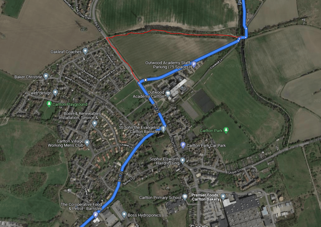
Living in the Athersley South area of Barnsley at the time, I would set off down Carlton Road, by a bit of an industrial area and then up Shay Lane – the B6132, following it left past the Outwood Academy. Note that this is where Google Maps is incorrect – it shows a route to get to the canal that is now blocked by the Academy, however a very short way further down Royston Lane, past Woodroyd Avenue, on the right you will see another signposted way to catch onto the route.
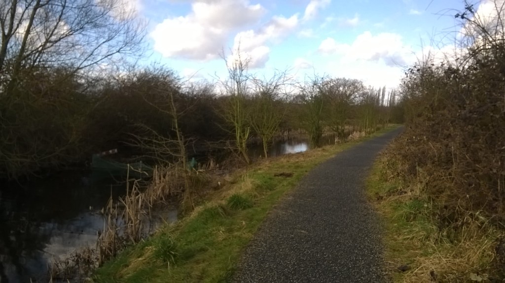
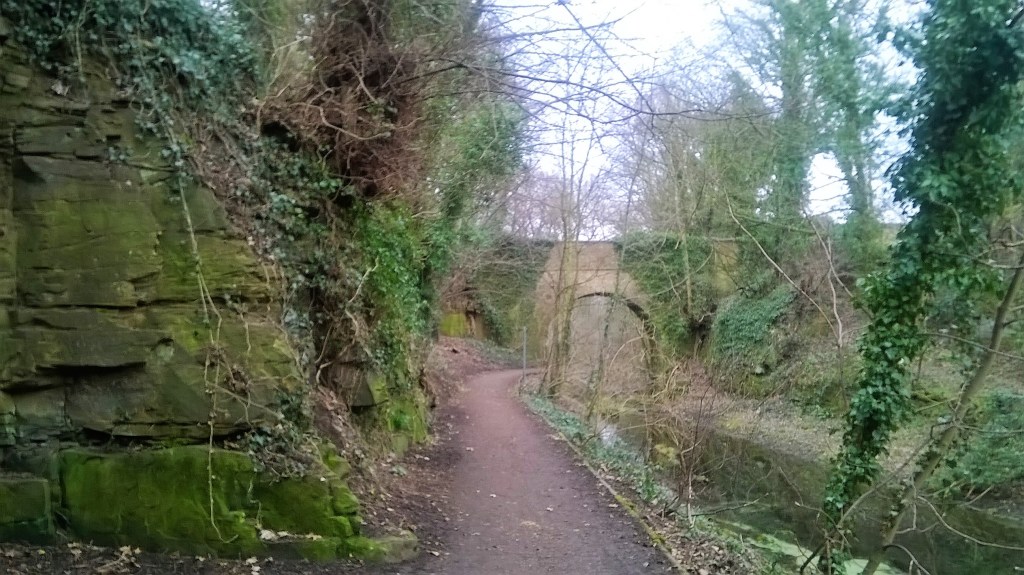
Now at Royston, here is where you come on the route and the tree lined, calm off-road section following Barnsley Disused Canal.
A Little About The Canal
The canal was built in the 1790s to serve the coal mines in the area, transporting the coal to markets around the country via the rest of the canal network in England, with rail eventually leading to the canal being redundant, declining by the mid to late 19th century. In 1863, parts of the canal structure were also found to be affected by subsidence due to the nearby mining. Following a couple of flooding instances, including one in 1946 that flooded a housing estate, the Aire and Calder Canal Company, who were running the canal, applied to abandon the waterways in 1947. With pemission granted in 1953, an unsafe aqueduct that was part of the canal was immediately demolished. A group had organised in the early 1990s, campaigning to restore the canal, even organising for engineers to provide a survey which found the restoration to be possible. Sadly, due to the pandemic and local council’s decision in 2019 which did not include the restoration of the canal, the group disbanded in 2020.
Back to the cycle
The route is broken up by just a couple of roads, past suburban areas and fields until you get to the aptly named Navvy Lane, with a slight bit on road then rejoining cycle route 67 in the direction of Walton North, still continuing the water theme, this follows Notton Cut, with steep edges of trees looking down on you on either side, carved out of the hillside, and the cut to your left, this is one of my favourite parts of the route.
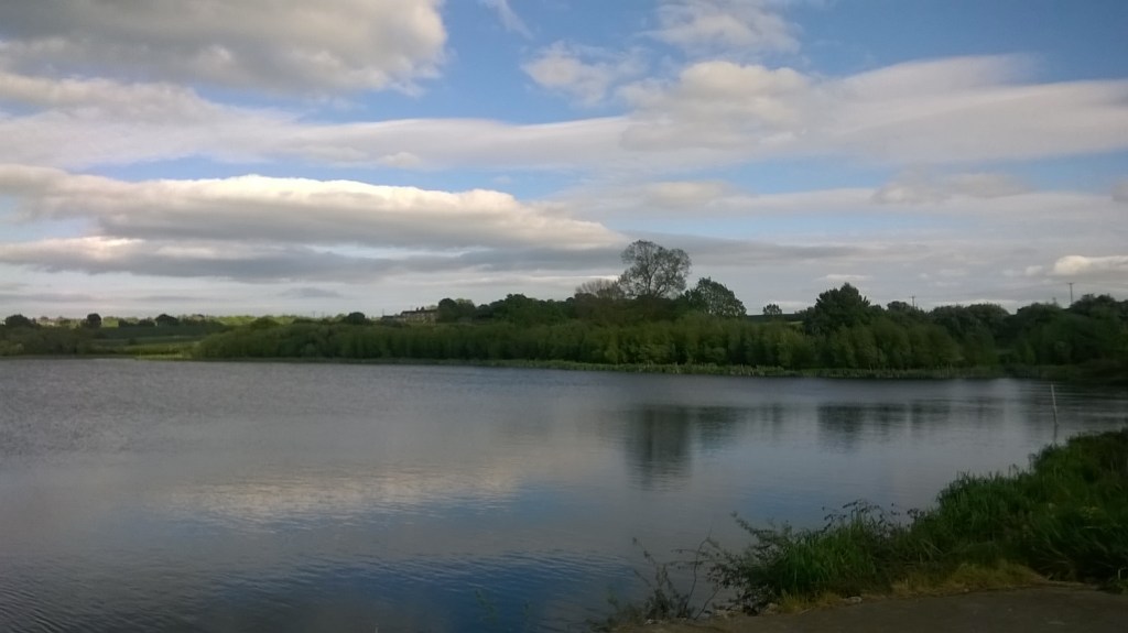
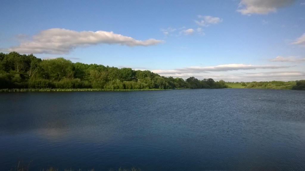
Then another tiny interruption by a road and you rejoin the Trans Pennine Trail / Cycle Route 67 and happen suddenly upon the beautiful expanse of water which is Cold Hiendley Reservoir. Cold Hiendley Reservoir was built to help provide water to the canal. Cycle along here and head into a wooded area, usually there were lots of families and dog walkers here. It’s another lovely part of the route, snaking through the trees, still following the trail of the old Barnsley Canal. It was along here, I recall hearing a woodpecker.
Skimming the edges of Waterton Park Estate and what used to be Walton Hall Lake there is a beautiful late 18th century, listed bridge known as Haw Park Bridge cycling through the cut stone and the trees dripping with ivy, the bridge emerges romantically from the greenery that surrounds it. I was delighted to find that John Singer Sargent also found this bridge intriguing, and completed a painting of it in 1906.
Continue to follow this along through the Golf Club and you can get the sense you’re nearing the next town as housing estates come into view either side. This also seems to be around the area where we lose the canal. When I cycled here the path gets really narrow and a bit overgrown as it edges towards Shay Lane, so please beware of other path users.

Shimmy down Shay Lane until you see the striking railway bridge cutting up the sky, and head left into Walton Colliery Nature Park. An incredible, well-maintained Nature Reserve, planted with various habitats including wetlands where water fowl can be spotted, trees with cuckoos. The Nature Park was usually quite busy with other cyclists, families and horse riders. One of the intersecting paths leads you out via going under a railway bridge and onto Oakenshaw Lane. Sections of the Barnsley Canal emerge here and there again at this point too. Oakenshaw is a pretty, but narrow and quite busy road, so I would urge caution here for cyclists.
Just before you reach the busy Doncaster Road that heads straight to Wakefield city centre, there is a tiny short cut to cut out a busy T junction, look out for the ‘Trans Pennine Trail North’ sign. Then it’s all pretty urban into the city of Wakefield, the road can get busy at rush hour but from what I recall, it’s not too bad! From there, explore the medieval chantry chapel, enjoy the view of the rushing weir on the bridge, enjoy local cuisine and pubs, delve into the world of brilliant local artists on The Art Walk, or at The Art House, or find out about some local history at The Wakefield Museum – including Charles Waterton, whose former grounds you will have just cycled through.
There you have it, an attempt at one of my favourite cycles, from memory, half recommendation, half total self- indulgence of my own brillant memories, to inspire myself.
Have you cycled here recently? Let me know what you think! I would love to come back soon.
My friend, an artist and psychogeographer John Ledger, was on the path in early lockdown in 2020 and shared some thoughts on it here.
Sources:
Barnsley, Dearne & Dove Canals Trust
Follow The Greedy Herbivore on Instagram and Facebook to keep up with my latest blog posts, reviews and ramblings, or follow through WordPress to receive notifications of new posts direct to your inbox.

Really enjoyed this Fiona. I always love reading about maps and places as a way of taking my mind off things. Although admittedly my own map work tends to get quite heavy. look forward to your next post!
LikeLike